
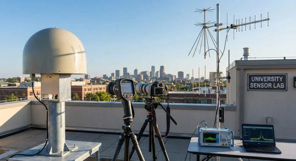
This article introduces the four primary sensor types used in UAP investigations, radar, FLIR (infrared), electro-optical (visible light), and signals intelligence (SIGINT) explaining what each measures, their vulnerabilities, and how to combine them for credible analysis. Radar provides range, velocity, and azimuth but is prone to artifacts like anomalous propagation, multipath, and velocity aliasing. FLIR detects infrared radiation, useful for unseen thermal structures, but can be misled by glare, blooming, and parallax illusions. Electro-optical systems capture visible imagery, offering shape and contextual detail, though they suffer from lens flares, bokeh, rolling shutter effects, and misperception of range. SIGINT records electromagnetic emissions, enabling geolocation and emitter fingerprinting, but faces multipath and timing errors.
It also emphasizes cross-sensor fusion as essential: robust cases require synchronized timestamps, multi-modal corroboration, atmospheric checks, and cooperative surveillance exclusion (ADS-B). It outlines best practices, preserving raw data, ensuring calibration, and applying environmental context, to avoid false positives. Official U.S. releases, like ODNI’s 2021 UAP report and Navy FLIR videos, are highlighted as both evidence and teaching tools. Ultimately, reliable UAP research depends not on single-sensor anomalies but on disciplined, multi-sensor consistency.
Why sensors matter
UAP research rises or falls on instrument data. Single-sensor detections are easy to overinterpret and easy to spoof, by nature, they are also easy to misread. A data-first workflow therefore begins with (1) understanding exactly what each sensor reports, (2) pre-registering error modes and uncertainty, (3) synchronizing time and geospatial reference across all channels, and (4) requiring cross-sensor consistency before upgrading claims.
For context, the U.S. government’s first unclassified summary (June 25, 2021) explicitly tied analytic limits to insufficient and inconsistent data, and emphasized the value of better collection and fusion. That report remains a useful baseline for what “counts” as evidence and what doesn’t. (Director of National Intelligence)
The four pillars: definitions, measurements, and outputs
1) Radar (Radio Detection and Ranging)
What it is / what it measures. Active radio systems transmit and receive electromagnetic energy to measure range (time-of-flight), bearing/azimuth, elevation, radial velocity (Doppler), and sometimes a proxy for reflectivity (Radar Cross Section, RCS). In practice, modern radars juggle pulse repetition frequency (PRF), beam shape, and signal processing to trade range for velocity performance. Authoritative primers: U.S. Navy’s NEETS Module 18; NOAA/NWS radar fundamentals. (tscm.com, NOAA National Severe Storms Laboratory, NOAA Institutional Repository)
Typical data products.
• Range/bearing/elevation tracks (2D or 3D)
• Doppler velocity (toward/away along the beam)
• Spectrum width/quality metrics
• RCS estimates (highly geometry-dependent) (National Weather Service)
Key error modes (radar).
• Anomalous propagation (ducting): super-refractive layers bend beams, yielding “ghosts” or displaced returns; can mimic high-speed or over-the-horizon targets. (NOAA)
• Range folding / second-trip echoes: targets beyond unambiguous range appear at incorrect ranges; corrected imperfectly by dealiasing/PRF strategies. (Iowa State Meteorology, NOAA National Severe Storms Laboratory, Radar Operations Center)
• Velocity aliasing: Doppler exceeds Nyquist → inbound appears outbound (or vice-versa). (Iowa State Meteorology)
• Multipath: surface/terrain reflections create false bearings or ghost tracks (especially low-grazing-angle maritime scenes). (tscm.com)
• Clutter & biologicals: sea clutter, rain, birds; polarization and correlation products help, but not always. (ICAMS Portal)
• Sidelobes / beamwidth limits: angular misplacement and unresolved multiple targets. (tscm.com)
Best practices (radar).
• Multistatic or multi-band corroboration: if one radar sees a target, attempt verification with a second radar at a different frequency/geometry. (tscm.com)
• PRF diversity & dealiasing: use multiple PRFs and algorithms to reduce velocity/range ambiguities. (AMS Confex)
• Atmospheric context: check ducting indices and AP advisories (NWS/NOAA); correlate odd tracks with refractivity profiles. (NOAA)
• Cross-check with ADS-B / cooperative surveillance to exclude known traffic (where policy permits). (Federal Aviation Administration)
Implications for UAP analysis. A single radar track, even with strong Doppler, is not sufficient to claim extraordinary performance. Range/velocity anomalies must be robust to dealiasing, consistent across PRFs, and ideally co-present in EO/IR and non-cooperative (no ADS-B) when it should be cooperative. (Federal Aviation Administration)
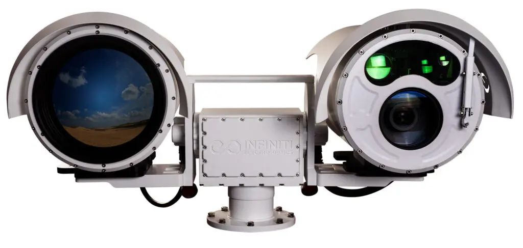
2) FLIR (Forward-Looking Infrared)
What it is / what it measures. FLIR sensors image mid-wave or long-wave infrared, reporting radiance (converted to apparent temperature) across a 2D array. Military targeting pods (e.g., AN/ASQ-228 ATFLIR) combine IR with laser range/designation and sometimes video/TV. Radiometry is not trivial: calibration, emissivity, and atmospheric transmission matter. (Raytheon News Release Archive, NIST Publications, NIST)
Typical data products.
• IR video/frames (MWIR/LWIR), sometimes with apparent temperature overlays
• Platform metadata: gimbal angles, field-of-view, zoom, track mode
• In some pods, correlated TV/laser data
Key error modes (FLIR).
• Non-Uniformity & thermal drift: pixel-to-pixel offsets change with internal temperature → fixed-pattern noise, false hot spots; corrected by NUC shutters/coefficient tables. (FLIR, FLIR Support, oem.flir.com)
• Blooming/saturation & glare: bright point sources overrun dynamic range; with gimbal de-rotation, glare can appear to “rotate.” (General IR/optical principle; see AARO case work on sensor artifacts in released examples.) (AARO)
• Atmospheric absorption/scatter (humidity, aerosols) that reshape signatures and reduce contrast. (NIST Publications)
• Parallax & range ambiguity when the platform is moving rapidly relative to an object, inflating apparent speed or displacement. (AARO)
Best practices (FLIR).
• NUC discipline: log when shutters fire; re-NUC after large temperature/zoom changes; preserve factory calibration files. (FLIR Support)
• Full metadata capture: UTC to the millisecond, gimbal az/el, slant range if available, FOV, zoom state, platform INS. (NIST Publications)
• Radiometric sanity checks: emissivity assumptions, atmospheric path length, and blackbody checks where possible (NIST-traceable if doing quantitative work). (NIST Publications, NIST)
• Cross-modal confirmation with EO or radar before claiming extreme kinematics. (U.S. Department of Defense)
Implications for UAP analysis. FLIR is superb at revealing non-visible thermal structure but it is also particularly susceptible to glare/bloom and range misestimation from moving platforms. Stronger claims require either range solutions (laser, stereo, or triangulation) or matches to radar/SIGINT. (AARO)
3) EO (Electro-Optical / Visible-Light Imaging)
What it is / what it measures. EO cameras record reflected/emitted visible light, delivering spatial detail, shape, and context (terrain, clouds, stars, other aircraft). EO is the human-intuitive layer in a multi-sensor stack.
Typical data products.
• RGB or monochrome imagery/video
• EXIF/metadata (timestamp, exposure, focal length); on platforms, add gimbal angles and INS
• Contextual cues (stars, horizon, planetary bodies)
Key error modes (EO).
• Lens flare/ghosting: bright sources just in/out of frame create geometric artifacts; aperture shape determines the shape of out-of-focus highlights (bokeh), which can appear triangular, pentagonal, etc. (Nikon Image Support, Photography Life, Luminous Landscape)
• Rolling-shutter distortions on CMOS sensors (skew/wobble/partial exposure) during fast motion or strobing light sources. (Teledyne Vision Solutions)
• Motion blur/panning artifacts: a slow shutter and camera motion smear lights into streaks; a steady pan can make a point light appear “equally fast” with the background smearing. (Photography Life)
• Forced perspective & parallax from a moving observer: stationary/slow objects can look fast or maneuverable. (AARO has a dedicated information paper.) (AARO)
• Satellite flaring: specular glints from LEO satellite panels are easily misread as “orb” UAP, especially near twilight or from altitude; AARO provides procedures and animations to check. (AARO, The Black Vault)
Best practices (EO).
• Raw capture + exact timing: preserve original files; never rely solely on re-encoded clips; maintain millisecond-accurate UTC.
• Optical hygiene: shade the lens; note Sun/Moon azimuth/elevation; log exposure/ISO/zoom. (Nikon Image Support)
• Geometry checks: use stars/planet positions to confirm orientation; star-field matching can provide absolute pointing.
• Cross-register to radar/FLIR lines of sight and SIGINT bearings. (AARO)
Implications for UAP analysis. EO alone can show shape and lighting behavior but struggles with range and true speed without additional geometry. When EO is consistent with FLIR (same line of sight/kinematics) and radar (track), confidence rises sharply. (U.S. Department of Defense)
4) SIGINT (Signals Intelligence)
What it is / what it measures. SIGINT comprises COMINT (communications), ELINT (non-communications electronics, including radars), and FISINT (foreign instrumentation). Practically, UAP-relevant SIGINT is RF-centric: spectrum occupancy, modulation, pulse descriptors, and geolocation of emitters via angle-of-arrival (AOA), time-difference-of-arrival (TDOA), frequency-difference-of-arrival (FDOA), or hybrids. Definitions and roles are set in Joint doctrine and NSA public overviews. (Intelligence Resource Program, Joint Combat Support, NSA)
Typical data products.
• Spectrograms, pulse descriptor words, center frequency/bandwidth/modulation
• Bearing lines (AOA), TDOA/FDOA solutions, and confidence ellipses
• Time-synchronized intercept logs
Key error modes (SIGINT).
• Multipath: reflections bias bearings; urban/maritime scenes are worst. (Agfranz, ITU)
• Clock/timing offsets: TDOA requires tight timing discipline; GPS multipath and oscillator drift introduce errors. (Defense Technical Information Center, NIST Publications)
• Emitter confusion: catalog mismatches; non-cooperative emitters can mimic others; co-channel interference raises the noise floor. (Rohde & Schwarz)
• Antenna geometry limits: small-aperture arrays suffer poorer angular resolution; poor baselines degrade TDOA accuracy. (ITU)
Best practices (SIGINT).
• Hybrid geolocation: combine AOA + TDOA (and FDOA where practical) to constrain solutions. (CRFS)
• Multi-site diversity with known, calibrated baselines and disciplined time sources (GPSDO/1 PPS or PTP). (Defense Technical Information Center)
• Emitter fingerprinting and catalog correlation (known aircraft radars/transponders, consumer drones, satcom). (NSA)
• Synchronized fusion: align SIGINT logs to radar and EO/IR within milliseconds to attribute emissions to visual/IR tracks (or lack thereof). (Intelligence Resource Program)
Implications for UAP analysis. SIGINT is a force multiplier: an absence of expected emissions (e.g., no Mode S/ADS-B, no tactical radar) alongside positive radar/EO/IR evidence can be probative; conversely, a positive match to known emitters is a fast down-select to prosaic. (Federal Aviation Administration)
Cross-sensor fusion: from “interesting” to “evidentiary”
A robust, replicable fusion pipeline is the difference between a viral clip and a scientific record. Minimum viable steps:
- Timebase discipline. All sensors must log UTC synchronized to ≤ 10 ms (GPS 1 PPS or PTP), with stable oscillator holdover. Otherwise, you cannot prove simultaneity. (SIGINT/TDOA errors and radar dealiasing are timing-sensitive.) (Defense Technical Information Center)
- Common reference frame. Convert each sensor’s native pointing (radar az/el, gimbal az/el, camera boresight) to a shared Earth frame; register EO/IR imagery to star fields when available. (AARO)
- Atmosphere and environment. Pull refractivity/ducting context (radar), IR transmission (humidity), Sun/Moon/planet/Starlink geometry (EO). AARO now provides procedures to test satellite flaring correlations. (\
What each sensor actually measures
Cooperative surveillance check. Query ADS-B/Mode S logs; a positive match can explain many air contacts; a negative match is a necessary but insufficient condition for UAP. (Federal Aviation Administration)
Kinematics sanity tests. Use range-consistent solutions (stereo, radar slant range, triangulated bearings) before inferring acceleration/turn rates. (AARO warns that parallax can inflate apparent speed.) (AARO)
Chain-of-custody & originals. Preserve raw files, calibration data, and intact metadata (never only social-media rips).
Adjudication with published frameworks. Use ODNI/AARO reporting formats so comparisons remain apples-to-apples. (Director of National Intelligence, AARO)
Error-mode field guide (quick look)
- Radar looks “fast”: Check for velocity aliasing, range folding, or ducting. If the target persists across PRFs and appears on a second radar with consistent kinematics and lacks cooperative transponder, escalate. (Iowa State Meteorology, Radar Operations Center)
- FLIR looks “hot”/“rotating”: Check NUC events, glare/bloom thresholds, and whether gimbal de-rotation could rotate the glare pattern. Seek EO corroboration and any range solution. (FLIR Support)
- EO shows “triangles/pyramids”: Test for bokeh (aperture-shaped out-of-focus highlights). Confirm focus distance and aperture; attempt a replicate with identical optics. (Luminous Landscape)
- EO “orbs” at twilight: Run satellite-flare checks for the specific time/azimuth; LEO constellations generate predictable specular events. (AARO)
- SIGINT bearing lines don’t meet: Consider multipath or baseline geometry insufficiency; try hybrid AOA+TDOA and lengthen dwell time. (Agfranz)
“What good looks like” sensor-specific best practices checklists
Radar collection checklist
- Record raw I/Q or highest-level moments available; save PRF schedule, beam pattern, calibration state, and clutter filter settings. (ICAMS Portal)
- Store Level II/III-equivalent base and derived products if using weather radars for sky surveillance; note Nyquist limits and unfolding algorithms used. (NOAA National Severe Storms Laboratory)
- Log environmental context: ducting indicators, temperature lapse rate, sea state (for maritime multipath). (NOAA)
- Attempt independent radar confirmation (different site or frequency). (tscm.com)
FLIR collection checklist
- Ensure NUC execution and logs; note internal shutter events and temperature. (FLIR Support)
- Capture full telemetry: gimbal az/el/roll, slant range if available, zoom, sensor mode, platform INS/GPS. (NIST Publications)
- Record parallel EO and, if possible, laser range/designation events (ATFLIR-like pods)
- Maintain radiometric traceability (blackbody check) for quantitative temperature statements. (NIST Publications)
EO collection checklist
- Save originals (RAW/ProRes); keep exact UTC and exposure/zoom/focus metadata.
- Log Sun/Moon/planet and Starlink geometry for the scene time; screen for flaring first. (AARO)
- Document aperture shape; test for bokeh by refocusing against bright point sources. (Luminous Landscape)
- If handheld or gimbaled, record platform motion to model parallax. (AARO)
SIGINT collection checklist
- Use calibrated timebases (GPSDO/1 PPS); capture wideband where feasible. (Defense Technical Information Center)
- Combine AOA + TDOA; maintain site geometry documentation; export confidence ellipses with each fix. (CRFS)
- Maintain emitter fingerprint catalogs; cross-check with civil/military databases (where lawful). (NSA)
- Time-align with radar/EO/IR logs to test co-occurrence. (Intelligence Resource Program)
Common cross-domain pitfalls and how to avoid them
- Assuming range from angular rate. Without range, apparent angular motion can be anything from close-in microdrones to far-off satellites. Solve range first (stereo/triangulation/radar slant). (AARO)
- Ignoring cooperative surveillance. ADS-B is not universal, but failing to check it invites false mysteries. Cross-match time/azimuth with ADS-B logs every time. (Federal Aviation Administration)
- Treating video compression artifacts as morphology. Use originals. Compression can reshape highlights and edges, creating “craft-like” silhouettes.
- Confusing sensor processing with object behavior. Gimbal de-rotation/glare “rotation,” rolling-shutter skew, and algorithmic de-aliasing look like motion; they may not be. (AMS Confex)
Data-first implications for UAP research, policy, and science
- Confidence scales with modal redundancy. A radar track that agrees with EO pointing, IR thermal contrast, and a SIGINT geolocate, while failing to match cooperative databases, demands attention. It crosses the threshold from “interesting clip” to evidence of an unknown. (Federal Aviation Administration)
- Infrastructure beats anecdotes. Standardized metadata, synchronized clocks, and shared formats (ODNI/AARO) allow cases to be compared year-over-year and across agencies, exactly what has been missing historically. (Director of National Intelligence, AARO)
- Safety of operations. Even non-extraordinary explanations (balloons, drones, flares) can present airspace hazards; rapid triage depends on fast access to ADS-B, satellite-flare predictions, and radar/SIGINT overlays. (Federal Aviation Administration, AARO)
- Epistemic humility with rigor. Official releases (DoD/AARO) illustrate how often sensor artifacts and environmental optics emulate UAP. But the same releases also show unresolved events. A rigorous workflow protects both possibilities: misidentification and genuine anomalies. (AARO)
Sensor-by-sensor “what each measures”
- Radar: time-of-flight – range; beam pointing – az/el; Doppler – radial velocity; amplitude/model – RCS. Vulnerable to AP, range/velocity aliasing, multipath. (Iowa State Meteorology, NOAA)
- FLIR: pixel-wise radiance in MWIR/LWIR; with calibration – apparent temperature. Vulnerable to NUC drift, glare/bloom, atmospheric absorption. (NIST Publications)
- EO: visible-band luminance and color; context (stars/horizon). Vulnerable to lens flare, bokeh shape, rolling shutter, motion blur, parallax illusions. (Nikon Image Support, Luminous Landscape)
- SIGINT: frequency/time features of emitters; AOA/TDOA/FDOA geolocation; catalog correlation. Vulnerable to multipath, timing offset, emitter confusion. (Rohde & Schwarz, Agfranz)
Minimal fusion rubric for casework
- Clock check (are timestamps coherent across all files?)
- Geometry check (do line-of-sight vectors intersect plausibly in 3D?)
- Environment check (ducting? humidity? twilight satellites?) (NOAA, AARO)
- Cooperative check (ADS-B/Mode S present/absent as expected?) (Federal Aviation Administration)
- Consistency check (are reported accelerations consistent with any range solution?)
- Attribution attempt (SIGINT/correlation to known emitters; if none, preserve as unknown pending more data). (NSA)
References
U.S. ODNI, Preliminary Assessment of UAP (June 25, 2021). (Director of National Intelligence)
DoD, Statement on the Release of Historical Navy Videos (Apr 27, 2020). (U.S. Department of Defense)
AARO (official): UAP Imagery and UAP Case Resolution Reports; Information Paper: Effect of Forced Perspective and Parallax, Information Paper: Correlations of Satellite Flaring with UAP Observations. (AARO)
U.S. Navy NEETS Module 18: Radar Principles (NAVEDTRA 14190). (tscm.com)
NOAA/NWS: Anomalous Propagation (AP); Doppler velocity/range folding references. (NOAA, NOAA National Severe Storms Laboratory)
NIST: IR camera calibration (NIST IR 8098). (NIST Publications)
FAA: ADS-B program pages (technology, operations, and FAQs). (Federal Aviation Administration)
NSA/Joint Doctrine: SIGINT definitions/overview (JP 2-0; NSA public pages). (Intelligence Resource Program, NSA)
Optics/Imaging references: Lens flare (Nikon support), Bokeh shape (aperture dependence), Rolling-shutter primers. (Nikon Image Support, Luminous Landscape
SEO keywords
uap sensor fusion, radar, flir, eo, sigint, uap data-first, radar anomalous propagation, flir nuc glare, eo bokeh satellite flares, sigint tdoa aoa multipath, aaro parallax paper, ads-b uap exclusion, verified uap multi-sensor evidence